A Complete Guide to Walking the Three Capes Track in Tasmania
/The last day of the Three Capes Track and I made it to the end of Cape Hauy!
“Look deep into nature, and then you will understand everything better”
The above quote was inside the cover of the “Encounters on the Edge” booklet provided by the Tasmania Parks & Wildlife Service (TPWS) to all those who embark on the Three Capes Track - and it perfectly sums up the feelings you will have on this incredible walk. Located on the Tasman Peninsula of Tasmania, the 4 day / 3 night Three Capes Track is 48 km long and highlights the rugged beauty and amazing coastline of this stunning peninsula.
The lighthouse on Tasman Island
The Three Capes Track is the newest addition to a growing list of TPWS walks in Tasmania, and is a huge success. I started my walk on January 24, which was still during summer break of Australian schools and therefore it was necessary to make my reservation several months in advance due to it’s popularity. The weather was warm, with some nice breezes and a few windy nights.
They say that Tasmania experiences “4 seasons in 1 day” - and I did see some of that during my walk. It didn’t rain during the day, but the clouds rolled in and out at a rapid pace - my photos show the range of weather experienced in just one day! This year there were a rash of bushfires in Tasmania, and while the fires were never close, some of the smoke in the mid-distance clouded our longer range views, especially on our first day.
Walking along a cliff’s edge during the Three Capes Track
To complete the Three Capes Track you can either walk independently or join up with an organized group. All walkers stay in huts, as it’s not possible to camp on this track. I’d recommend going as an independent walker, which is what I did - it’s less expensive but still not cheap compared to many other walks available.
One of the criticisms of the Three Capes Track is the price. Currently it costs A$495 for an adult, and this includes: entry to Port Arthur Historic Site; car parking at the site; the starting cruise (which departs 2x daily)'; 3 nights self-catered accommodation in huts on the track; and your return bus transfer from Fortescue Bay back to Port Arthur Historic Site (also 2x daily) at the end.
Because of the cost, you will not find many hardcore hikers on the track. Within my group of 48, there were a few multi-generational families (one grandmother, daughter and granddaughter that were celebrating the grandmother’s 70th birthday, as well as one large family with a 2 1/2 year old that they partially carried in a backpack carrier and who walked about 1/3 of the time), many Australians on summer holiday and a few Americans other than myself.
It’s not a particularly challenging walk, but it’s definitely worth doing in order to truly experience this area of Tasmania - the scenery was often jaw-dropping. I highly recommend this walk, and here I provide all the details you need in order to plan and thoroughly enjoy this beautiful walk.
ANDIAMO!
A view of Tasman Island from day 3 of the Three Capes Track walk
RESERVING YOUR SPOT
The Three Capes Track is popular, so it’s important to make your booking as far in advance as you can. This TPWS website https://www.threecapestrack.com.au/ provides the booking information you will need. Some key information:
Each day, a maximum of 48 walkers are granted permits to walk the Three Capes Track
The Three Capes Track is a 4 day/3 night walk. Everyone walks in the same direction and you must keep moving toward the next hut each day, which ensures that everyone has a bunk to sleep in at night
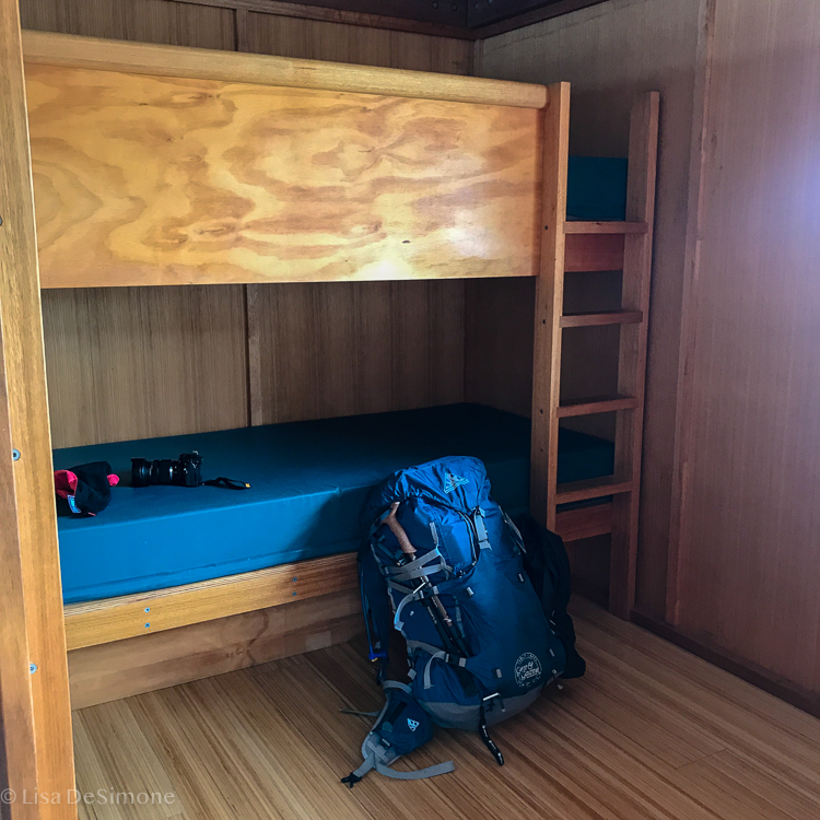
You will be assigned a bunk room by the park service, and likely sleep with the same bunkmates each night. I was walking by myself and shared my 4 person bunk room with three lovely Australian ladies who were walking together. I am guessing there is a way during registration to request a bunk room for families or friends traveling together.
GETTING TO THE START AND BACK
The Three Capes Track actually starts at Port Arthur Historic Site, the location of a brutal penal colony from 1833 to 1877. The open-air prison, which now is an immaculately maintained national heritage site, is one of Tasmania's top tourist destinations. You can drive yourself there and leave your car (which I did) or arrange to take the bus through one of the companies that offer regular passenger transport services between Hobart and Port Arthur.
The Three Capes Track starts at the Port Arthur Historic site
Traveler Tip: Your payment for the walk also includes admission to the Port Arthur Historic Site, so if you are driving yourself there I would recommend planning to spend a few hours touring this very interesting site the day you depart or even the day prior.
WHAT TO PACK
The TPWS website provides a detailed gear list. I would recommend following the guide fairly strictly (i.e., only pack what they suggest). There is really no need to pack anything beyond what is on the suggested gear list. I added a “few” extra things and my back ended up weighing 18 kgs including food and water — that’s way too heavy!
Me and my too heavy pack
Each bunk in the bunk rooms have decently comfortable twin-sized mattresses, but you need to bring your own sleeping bag (and pillow if you need one). Don’t forget your ear plugs as you will be sharing the room with strangers and you never know who snores!!
The bunk rooms do not have electricity, but there are USB ports in the common area for charging cell phones and other devices. There are no regular plugs available for charging, so bring extra camera batteries.
Remember to bring a headlamp or torch for those late night walks to the loo, which at times can be a bit far away.
You will need to bring all your own food - none is provided nor available. You also need to bring your own personal cutlery, plate and drinking cup.
Pay special attention to the wet weather gear they recommend: I was lucky and didn’t need it, but I was prepared just in case.
Make sure to bring a light day pack…there are two times on this hike when you are able to leave your large rucksack behind and just carry some essentials.
Water is available at every hut, but there is none between huts so you have to carry a day’s worth of water each day. Make sure to have capacity for at least 2L of water with you: it’s more than enough.
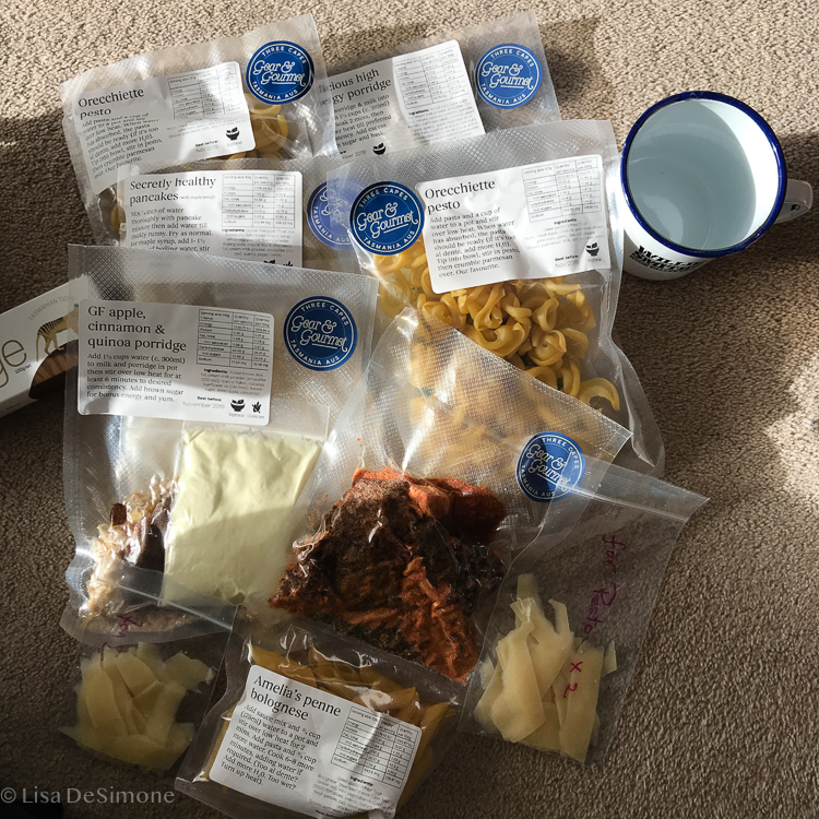
Traveler tip: I didn’t want to lug my own gear from the United States, so I hired a 50 litre rucksack and sleeping bag, as well as all my meals, from Three Capes Gear & Gourmet located in Hobart (link found here). It’s a great service which I highly recommend!
Somehow, even though my pack was so heavy, I didn’t have enough food! I bought 3 breakfasts and 3 dinners from Gear & Gourmet, and figured I could just eat almonds and some fruit for lunch and no snacks. It definitely wasn’t enough and in the end, I was taking people’s extra food for my last day’s meal :-( If I did it again, I would make sure to have something to eat for each lunch and snacks as well.
WHAT TO EXPECT AT THE PUBLIC HUTS
The eco-accommodations on the track are thoughtfully designed and constructed, taking nature as their inspiration. Frankly, they are the nicest public huts I have ever seen. As they are so new, they are super clean and well-maintained. There is a park ranger at each hut who is there to answer any questions you may have and also to provide a briefing each night describing what to expect on the next day’s walk. The huts all had a lovely large deck with some lounge chairs where you could sit and enjoy the views.
Each hut has 2 spacious common areas with plenty of tables and chairs for your meals or to hang out. They also have yoga mats, some books, games, and playing cards - and there is a stove to heat the huts if you hike in colder weather. The large common rooms also house the kitchens, which come equipped with gas cooktops, pots, pans, basic large cooking utensils, and water that is safe to drink. You only need to bring your own personal cutlery, plate and drinking cup. Remember: you will need to bring all your own food - none is provided nor available. There are common, long drop toilets housed in buildings near to the main huts. They were very clean as well. The 2nd hut, Munro, even has a “hot” bucket shower option, which worked really well and was a nice surprise.
WHAT TO EXPECT ON THE TRAIL
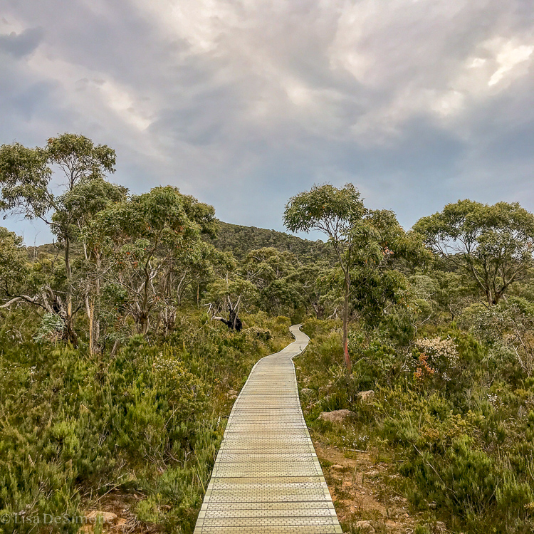
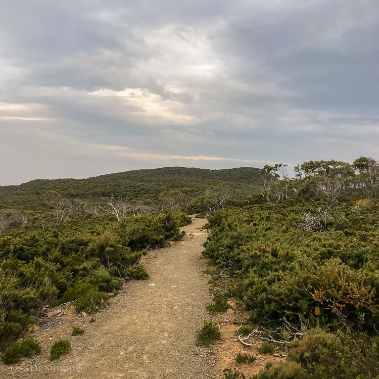
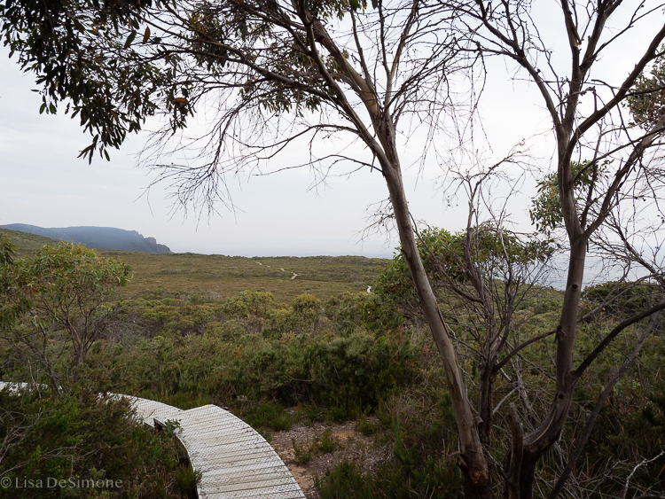
The track itself is very well maintained, and is mainly packed dirt and gravel or elevated wooden boardwalks. Along the way there are creative and artistic installments that you can read more about in the supplied booklet as you walk. Each person walks at their own pace: there is really no chance to get lost.
The trail meanders along many high and dramatic sea cliffs, and there are no fences or barriers of any kind along the edge, making the walk feel all the more authentic. Beyond the track in some places there are sheer and long drop offs to the sea below, but it’s still completely safe as long as you stay on the track.
Part of the trail on day 4 of the Three Capes Track
The track is extremely clean: there was no rubbish of any kind that I could see. There are no facilities along the track: toilets are provided only at the overnight huts. Although there is some elevation gain along the way, it really is a fairly moderate walk and can be enjoyed by most everyone.
THE HIKE ITSELF: A DAY-BY-DAY DESCRIPTION
DAY 1: Port Arthur to Surveyors Hut (boat cruise then 4 km walk)
Your adventure begins at the Port Arthur Historic Site pier. When you book your walk, you will have to choose a boat departure time. You should plan to check in at least 45 minutes in advance of your departure time. The check-in desk is located on the ground floor of the Port Arthur Historic Site visitors center. First up is a boat cruise out to Arthur’s Peak and Crescent Bay. The boat ride lasts for about an hour or so before you are deposited onto the sandy beach of Denman’s Cover in Tasman National Park. The first day’s walk is an easy one: it took me less than 2 hours to reach Surveyors, the first public hut on the walk. (I am not a fast walker and stop often to take photos).
View from the boat cruise as we head to the start of the Three Capes Track
A ranger was at Surveyors to greet all the walkers and give them the lay of the land, as each hut is more or less designed the same. They show you to your shared bunk, explain the kitchen set up and common room, etc. This is a very easy day, with plenty of downtime at the hut, so bring a good book or just sit on the deck and enjoy the scenery. Because the Day 1 walk is so short, many people brought perishable meat for dinner that night. Surveyors Hut even has an outdoor BBQ, and there were a few savvy people that were grilling steaks for their first night’s dinner. What a great idea. Boy was I jealous!!
DAY 2: Surveyors Hut to Munro Hut, 11 km walk
There is no need to rush out after “brekkie”, because the Day 2 walk is also pretty easy and short. High temperatures were forecast for our 2nd day on the track, so most people did leave early to try and beat the heat. I left Surveyors Hut at 7:45am and arrived at Munro Hut at 11:15am, taking two nice stops along the way. Lucky for us, the weather forecast wasn’t correct - we had lots of cloud cover and nice winds, which made the walk so much more pleasant, but was not great for photos.
Day 2 of the Three Capes Track was overcast, but still great views
Munro Hut was just as nice as Surveyors, with a really large deck that afforded views of the cliffs of Munro Bright all the way to Cape Hauy (the last day’s walk). The only downside of Munro Hut is that the loo is a fairly decent walk away from the bunk rooms, which is a real bummer in the middle of the night.
DAY 3: Munro Hut to Retakunna Hut, via Cape Pillar - 19 km walk
I woke up really early, made myself some coffee, and took a seat on the outside deck to watch the sky change colors and the sun paint the cliffs. Early morning is my favorite time of day, and the stillness and serenity of this morning’s sunrise was one I won’t soon forget.
Day 3 was my most favorite day of all. This day’s walk is beautiful - there are so many sheer sea cliffs along the way! Also, you have to only carry a daypack for most of this walk, which was a welcome relief. Leaving my big rucksack behind, I left Munro Hut at 9:15 am for the walk out to Cape Pillar and back (I returned around 2:45 pm). There are several spots to relax for lunch along the way, and with so many great photo opportunities, this is truly a day to take your time and enjoy the spectacular scenery and fresh air. Once you return to Munro Hut you will likely have time to relax if you want, as the walk to Retakunna Hut isn’t very long (I spent about 30 minutes back at Munro Hut and it took less than an hour to get from there to Retakunna).
DAY 4: Retakunna Hut to Port Arthur, via Cape Hauy and Fortescue Bay- 14 km walk
The terrain and scenery on this last day was quite varied…lots of ups and downs, dramatic cliffs of Cape Hauy, lush rainforests and beautiful heathlands. Although the booklet describes the start of this day’s hike as “climbing Mount Forescue”, it is really not that dramatic, especially if you have ever really climbed a mountain before :-) Yes, there is a reasonable elevation gain, but the slope isn’t steep. Once you get the climb out of the way, the rest is easy!
Again, there is an opportunity to carry only a daypack for part of the hike: at the junction for the start out to Cape Hauy there is a spot where you can leave your big bag and carry only your essentials. This was another great hike up to some amazing views at the top of Cape Hauy: quite spectacular!
Amazing views can be found from the viewing platform at the end of Cape Hauy on day 4.
Once you come back to the junction and repack your things into your large rucksack, it’s pretty much all downhill to Fortescue Bay. If you have time before the bus back to Port Arthur you can take a dip in the crystal clear water. At a minimum, you can buy yourself a well-deserved ice cream at the little shop there!!
Including the walk to Cape Hauy, stopping for lunch and many photo breaks, it took me around 6 1/2 hours. Make sure know your walking pace and plan accordingly, as you will need to be at Fortescue Bay in time to catch your reserved bus departure time.


